How Not to Get Lost Hiking
Kevin Felts 04.23.18

What steps could someone take to not get lost while hiking? Let’s take Bob for example. Bob wants to go hiking, so he drives out to a section of the national forest, parks his truck on the side of the road and walks into the wilderness.
After a couple of hours of wondering aimlessly through the woods, Bob decides it is time to head back to his truck. The problem is, Bob has no idea where his truck is at. Bob did not even take he time to grab a compass on his way out the door. He has no GPS, nor phone service.
Let’s take a few minutes to talk about what Bob could have done differently so he would not get lost.
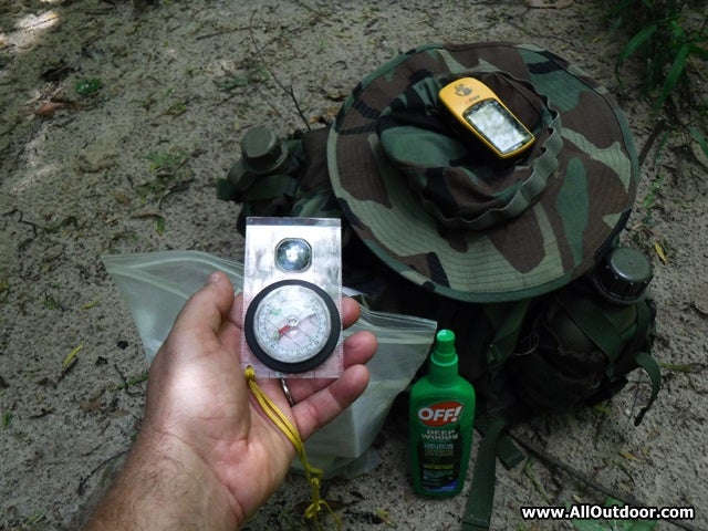
Before we begin, I would like to explain my experience with land navigation. In the early-1990s a buddy of mine, who served in the 82nd Airborne, taught me various navigation skills. We would do day hikes which would cover maybe 10 miles. From those teachings I expanded my knowledge with real world experience. Over the past 20-25 years I have been on dozens of wilderness hikes where the only navigation I had was TOPO map, compass and hand-held GPS.
Learn Basic Navigational Skills
We have talked about this in other articles:
How To Follow a Compass For Land Navigation
Four Tips On Learning Navigational Skills
How to Read a Topographical Map
How to use a Topographical Map to Get a Bearing
One of the absolute easiest ways to practice navigation skills is to walk around the neighborhood with a compass. The person will hopefully have an idea where their house is at. Practice setting the compass to where it points back to the house. Shoot the azimuth (degree) of a street. Are the streets pointing east, west, north, 60 degrees, or 45 degrees?
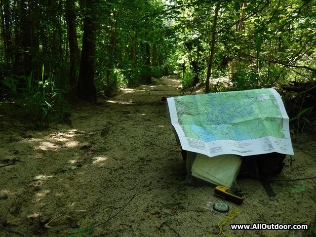
Bring a TOPO map of the area while walking around the neighborhood. Use the map to find bearings of the streets. Then check the bearing while looking at the street.
Practice using a GPS before heading into the wilderness. One thing I did with my first GPS (Magellan Trailblazer, around 1993), I set my house as a waypoint, then walked around the neighborhood and used the GPS to set my compass. Before the GPS was ever used in the wilderness, I had several hours of practice in a controlled environment.
Why walk around the neighborhood? Because “hopefully” the person will not get lost.
Take a Compass Reading Before Heading Out
With the Bob example, let’s say he left his truck and had a heading of 30 degrees. Hopefully, rather than walking in circles, Bob will use his compass to walk in a straight line. All Bob has to do is turn the compass 180 degrees, turn around, and walk back to the truck. He starts out with a compass heading of 30 degrees, turn the compass to 210 degrees, and walk a straight line back to the truck.
Another example, let’s say Bob leaves his truck and walks east. He knows all he has to do is walk west and he will eventually hit the road.
To do any of this, the hiker has to know what direction they originally started out in. A simple pocket compass is better than nothing.
Time, Pace Count, and Distance

Some people count their paces to estimate distance. I use time. On rugged or hilly terrain, I know my average speed is a little more than one mile per hour. On flat terrain with no obstacles, think hiking trail or logging road, my average speed is around two miles per hour. Keep in mind this is with a loaded pack, fatigue, heat, and rest breaks all included in the estimates.
Bob has no idea how long he has been gone, nor does he have any idea of how much distance he has covered. This makes it difficult to estimate his distance to the truck.
If Bob had traveled in a straight line into the national forest, and kept an eye on his watch, he would know about how far he had traveled, and about how long it would take him to hike back to the truck.
TOPO Maps and Location
Something I highly recommend is taking a rest break at regular times. While resting, get the TOPO map and GPS out, and find your location. At the bottom of the TOPO map is a scale. Cut a small stick the length of the scale and it can be used to estimate distance on the map.
Remember, time is distance. If someone is traveling around one mile per hour, and they stop at the 90 minute mark, they may be around a mile and a half from their last location.
Compare that to someone who is traveling around two miles per hour, and does not stop for three hours. They may be six miles from their last location. Hopefully they did not get off course during that six miles.
Checking location at regular intervals allows someone to keep an eye on their bearings and make sure they are not getting off course.
Keep an Eye on Landmarks
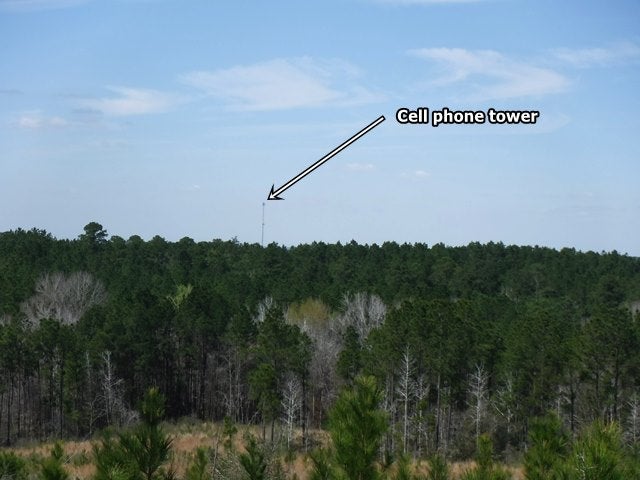
When starting the hike are there any visible landmarks? Maybe a cellphone tower, hilltop, canyon, or river?
For example, a few months ago one of my dogs (Zoey) and I went on a hiking trip. There was a cell phone tower a few miles from my location that was used as a navigational aid. I knew where I wanted to go was a mile or so to the east of the tower.
As Zoey and I skirted the rolling hills, I used a 50 cent pocket compass to estimate the direction we needed to go. With nothing more than a pocket compass, cell phone tower in the distance, and an estimated distance of our target from the tower, we were just a few hundred feet off target when we arrived.
Final Thoughts
Well guys and gals, that is about it for now. Hopefully something was covered that can help someone.
In all honesty, we just covered the basics. We did not even mention triangulation, or changing course, degrees, or any type of math.
This should be good enough for now. Let’s cover some more navigational topics in the near future.


